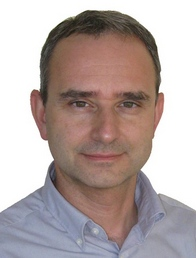
Antonio Vettore
 is full professor of geomatics at the University of Padova. Author of more than 240 publications in the fields of Surveying, Photogrammetry, Cartography (Geomatics). He has several scientific collaborations with the University of Calgary (Canada) Department of Geomatics, University California at Berkeley, Department of Forestry Science, University of Melbourne (Australia) Department of Geomatics, ETH Zurich Polytechnic, Institute of Photogrammetry, University of Technology Vienna.
Visiting scholar (1999) at the Virtual Information Technology Group, Institute for Information Technology, National Research Council of Canada NRC. Visiting Professor (2001) University of Calgary (Canada). Visiting Professor (2006) Department of Geomatics University of Melbourne (Australia) .Visiting Professor (2008) Technological University of Buenos Aires (UTBS).
Research topics: 1) Mobile Mapping Systems, Inertial Navigation Systems, Road Tracking, Image Processing. 2) Laser Scanner applications and GPS / INS techniques for Surveying and 3D modeling of cultural heritage sites. 3) Processing of LiDAR data from airborne or ground sensors (ALS & TLS), both discrete return and full waveform.
Head of research units in several national (Italian Ministry of Education, Italian Civil Protection Agency) and international projects. He is actively involved in the International Society of Photogrammetry and Remote Sensing and served in 2000-2004 as chair of the Working Group "Kinematic and Integrated Positioning System". He is member of the Scientific Committee of MMS (Mobile Mapping Systems) at ASPRS (American Society of Photogrammetry and Remote Sensing)
He was chief organizer and host for international conferences on: (i) The Role of Geomatics for hydrogeological Risk (Padova 11 to 13 February 2013) (ii) International Symposium on Mobile Mapping Technology MMT07 (Padua, 2013) (iii) 2nd Italy – Canada workshop on Applications of 3D Digital, Imaging and Modeling, Padova, May 17-18 2005.
|
 www: Homepage
Publications www: Homepage
Publications
 Skype: antoniovettore Skype: antoniovettore
|
 Email: antonio.vettore(at)unipd.it Email: antonio.vettore(at)unipd.it
 Phone: +39 049 827 2688 Phone: +39 049 827 2688
|
Last updated on 26 June 2014


 Alberto Guarnieri received the degree in Electrical Engineering at the University of Padova (Italy) in 1998, then in 2004 he got the PhD in Geodetic and Topographic Sciences at the University of Bologna (Italy).In 2003-2004 he was visiting researcher at the Department of Geomatics Engineering of the Schulich School of Engineering, University of Calgary, Canada. From November 2008 to November 2015 he was assistant professor, and since 2015 he is associate professor at the Department of Land, Environment, Agriculture and Forestry (TESAF) of the University of Padova. His research activity is mainly focused on 3D modeling supported by terrestrial laser scanning and digital photogrammetry for cultural heritage and hydrogeological risk mapping. He is also involved in the development of land-based and UAV-based low-cost mobile mapping systems. He currently teaches higher education courses on Global Navigation Systems (GNSS) and Geographic Information Systems (GIS) at the School of Agricultural Sciences and Veterinry Medicine of the University of Padova.
He has (co)authored more than 130 papers, published on international scientific journals, books and national or international conference proceedings.
He is active in the International Society of Photogrammetry and Remote Sensing (ISPRS), serving from 2012 to 2016 as secretary of Inter-Commission Working Group ICWG I/Va - Mobile Scanning and Imaging Systems for 3D Surveying and Mapping.
 Francesco Pirotti is associate professor at the TESAF Departmentof University of Padova. His research interests are:
 Marco Piragnolo got his graduate degree at University of Padua in Natural Science, Conservation of Nature and Natural resources, with a thesis of fluvial geomorphology and geophysics. Then he got a specialization in Geographic Information Systems and Remote Sensing at University of Architecture of Venice (IUAV). He currently holds a position in CIRGEO where he is working as developer for Nasa World Wind platform and he participated at two editions of World Wind Europa Challenge. He has experience in natural and environmental field, geographic information systems (GIS), WebGIS and programming with and several languages (R, Java, Php, MySql, Html).
 Born in Valdivia, Chile (1987), Erico has been working for the FRI (Forest Resource Inventory) of the Province of Ontario, Canada. Developing skills in the field data acquisition and photo-interpretation in the Boreal forests. Erico has been involved in several projects regarding geomatics topics and biomass projects as associated resercher in sevel countries as Chile, Bolivia, Italy, Czech Republic, Ghana, among others. His main research of interest is in developing new remote sensing techniques in forest measurements, using accurate biomass allometric models specie-sites specifics in different enviromental conditions.
 Andrea is Associate Professor of Geomatics at the TESAF Department of the University of Padua and member of the Interdepartmental Research Center of Geomatics (CIRGEO). He previously was Associate Professor of Geomatics at the Department of Civil and Environmental Engineering of the University of Florence (2020-2023). He received his MSc Degree in Computer Engineering and his P...
 Francesca, M.Sc. in Environmental Physics at University of Turin.
In April 2014 she received her PhD in “Monitoring of Systems and Environmental Risk Management” at the University of Genoa, during which she dealt with low-cost sensors for the detection and monitoring of environmental parameters and developed a real time web-based monitoring tool able to acquire, manage, sm...
 Daniele Perissin was born in Milan, Italy, in 1977. He received his Master (laurea) in Telecommunications Engineering and his Ph.D. in Information Technology (cum laude) from Politecnico di Milano in 2002 and 2006, respectively. He joined the Signal Processing research group at Politecnico di Milano in 2002, and since then, he has been working on Time Series InSAR analysis in t...
 Prof. Greg Biging, Professor Emeritus at Dept of Environmental Science, Policy, & Management at UC Berkeley in Forest Biometrics and Remote Sensing, has been guest at CIRGEO and TESAF Department several times in the past years collaborating on research regarding remote sensing of environment, specifically in the field of forestry.
