
 Earth Sensing Summer School 2025
Thank you to the 100+ applicants to the Earth Sensing Summer School! We truly appreciate your interest. Unfortunately, due to accommodation constraints, we were only able to select 40 participants.
Some selected pictures can be found HERE.

If you’re passionate about these topics and were not selected, you can consider applying to the ‘parent’ summer school “Sensing Mountains 2026” organized by the Department of Geography of the University of Innsbruck.
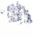
Below the map with affiliations of applicants.
Description
The Earth Sensing Summer School trains early stage researchers and motivated higher education students in using Geomatics approaches for rigorous surveying, processing and representation of spatial data in different environments, from forestry to urban areas, and for different applications, e.g. forest management ecology, hydrogeological risk assessment.
Participatns will learn to use remote and close-range sensing technology for collecting data on the field with practical hands-on work, seminars and dissemination activities to peers.
Several challenges are proposed with assignments tackling different aspects of urban and natural environment - (see Team Challenges and supervisors for specific details).
Intended Audience
The Earth Sensing Summer School is designed for any motivated student at doctorate level; priority will be given to PhD students and post-docs, but motivated graduate students, young researchers and practitioners are welcome, provided they are passionate about the topics covered.
Important Dates
- 7 March 2025 - Registration deadline
25 March 20251 April 2025 - Communication of final decision of acceptance- 10 April 2025 - Deadline for payment for covering accommodation and meal fees - cancellation policy: no refund possible (but you can speak to the organizing team to find a solution, e.g. a substitute from the waiting list or proposed)
- 7-13 September 2025: Summer school!
Location
San Vito di Cadore - Italy - Dolomite Mountains
The closest airports are Venice and Treviso. Several bus companies provide connections with San Vito (including Flixbus) from major airports and cities.
Villa Maria Ausiliatrice: meals, accomodation and seminars
Centro Studi per l’Ambiente Alpino (Study Center for the Alpine Environment) - seminars on monday and tuesday + excursion and sensor show - 30 min walk from Villa Maria Ausiliatrice


Registration
Accommodation and meals *: 550 Euro
*this fee covers full accommodation for 7 days - 6 nights, meals and access to all training material, lecture room, sensors etc… It includes the registration to the Italian Society of Photogrammetry and Surveying (SIFET) for 2025.
Please REGISTER HERE.
Warning
Registration is via a Google form which requires to sign-in using a google account because you will be asked to upload some documents as specified below (CV, motivation letter, etc…). If you do not have a Gmail account please either (1) create one or (2) use an alternative registration form HERE or (3) download the registration form here and send it to us via email here with the requested attachments specified in the form (CV, motivation letter, etc…)
See important dates for other deadlines.
Upon registration, each applicant is requested to send:
a short motivation letter (max. 500 words)
a one page CV
an abstract of the participants’ current work (max. 2 pages, *.docx or *.odf).
Participants will be selected by a commission on the basis of the material provided upon registration.
Keynote speakers
- Mauricio Acuna (LUKE - Finland) - Research Professor in Automation and AI in Forest Operations
- Nicholas Coops (University of British Columbia - Canada) - Canada Research Chair in Remote Sensing, Department Head Forest Resources Management
- Hans-Gerd Maas (Technical University Dresden - Germany) - Past President ISPRS Commission V (Close-Range Vision Techniques) and past Dean of the Faculty of Environmental Sciences, TU Dresden and chair of photogrammetry. Title: “Terrestrial photogrammetric techniques for glacier monitoring at high spatial and temporal resolution”
- Michele Crosetto - (Centre Tecnològic de Telecomunicacions de Catalunya - CTTC Spain) - Head of the Geomatics Division CTTC. Advisor of ISPRS Working Group III/3 “Active Microwave Remote Sensing”
- José Manuel Delgado Blasco (ESA Φ-lab - Italy) - is working at the Φ-lab Invest Office supporting development of EO innovative solutions, user-driven and commercially focused in the InCubed programme. Past EO engineer support at ESA/ESRIN and guest lecturer in KU Leuven.
Seminars/Lectures
- Carlos Cabo (University of Oviedo, Spain) - 3DFin tree parameter extraction from 3d point clouds
- Sebastiano Chiodini / Giacomo Colombatti (CISAS -UNIPD) - Demonstrating a LiDAR-equipped Remote-Controlled UGV for Woodland Terrain Scanning
- Gherardo Chirici (Geomatics LAB - DAGRI University of Firenze) - Integration of multisensor remote sensing for mapping and modelling trees and forests.
- Enrico Magazzino / Francesco Pirotti (UNIPD) - Thermal Remote Sensing for detecting vegetation anomalies - from satellites to drones
- Roberto Pierdicca (Geomatics LAB - Polytechnic University of Marche) - GeoAI in the context of natural ecosystems.
- Erico Kutchartt (Catalonia Forestry Tecnologies Research Center - CTFC - Spain) - “Mapping optimal biorefinery plant locations using Earth observation data in the Mediterranean region”
- Xinlian Liang (State Key Laboratory of Information Engineering in Surveying, Mapping and Remote Sensing, Wuhan, China) ISPRS Working Group III/1 - Single-tree based forest assessment and monitoring.
Sensors
We will use several sensors for collecting data.
- Stonex x120go SLAM
- Satellite data OPTICAL/RADAR
- Terrestrial Laser Scanners
- DJI / Livox L1/L2
- XGRIDS LIXEL L2 PRO SLAM
- STONEX S999 GNSS receiver
- Multispectral/thermal camera: MicaSense ALTUM PT
- Rover with stereo-camera, LiDAR & GPS-RTK (by CISAS - E-forester MSCA Staff Exchange)

Sponsors and supporters
Sponsors


Supporters


Team Challenges and supervisors
Each participant will select which challenge she/he prefers and be assigned to the team. We will try to assign everyone to their first choice.
Each challenge implies collecting field data with sensors and then processing it in the lab to reach the goal assigned by the supervisor with methodology chosen together with the students.
The teams will present their results the last day before the good-bye party!
A. Virtual 3d Forests for Foresters Challenge
Supervisors:
Anna Iglseder (TU Wien, Austria)
Carlos Cabo (University of Oviedo, Spain)
Survey a forest stand with various laser scanning and with photogrammetric methods. Different sensors ranging from low-cost to high-end devices will be used to collect data of entire forest plots. The objective is the 3D-reconstruction of individual trees and individual tree parameters from the collected data.

B. Ground movement from RADAR InSAR Challenge
Supervisors:
Michele Crosetto - (Centre Tecnològic de Telecomunicacions de Catalunya - CTTC Spain) - ISPRS WG III/3
Rasoul Eskandari (Politechnic of Milano | Polimi · Department of Architecture, Built Environment and Construction Engineering)
Deriving ground deformation time series in San Vito area exploiting Sentinel-1 SAR images using SARAXIO software package, and comparison with European Ground Motion Service (EGMS) datasets.

C. Urban 3D modelling challenge
Supervisors:
Caterina Balletti (IUAV University in Venice, Italy) - ISPRS WG II/7
Andrea Martino (IUAV University in Venice, Italy)
Acquire and integrate point clouds from Mobile Laser Scanning and UAV photogrammetry to produce an updated urban 3D model and use it in QGIS to assess pedestrian accessibility, clearances and obstacles (architectural barriers, discontinuities, slopes, bottlenecks, street furniture). Expected outputs: a replicable end-to-end survey and processing pipeline; quantitative accessibility indicators and thematic maps supporting planning decisions.

D. Remote Sensing and Environmental Modelling
Supervisors:
- Thomas Zieher (Department of Natural Hazards, Austrian Research Center for Forests (BFW) ) - ISPRS WG III/8
Parameterize and apply a physically-based soil-vegetation-atmosphere-transfer (SVAT) model and integrate remote sensing data for deriving input parameters (and eventually validation) of forest stands.

E. GeoAI in Forest Environments
Supervisors:
Roberto Pierdicca (Università Politecnica delle Marche) - ISPRS WG III/8
Mattia Balestra (Università Politecnica delle Marche)
Train an instance segmentation deep learning model for the recognition of forest, grassland and other types of areas, using the “Ultralytics YOLO v11” framework. Testing the model on high-resolution images to evaluate the performance in recognizing new geographical areas that were not seen in the training phase.

F. Photogrammetry and Nerf/Gaussian Splats in Forest Environments
Supervisors:
Mauricio Acuna (LUKE - Finland) - Research Professor in Automation and AI in Forest Operations

Local Organizing Committee
- Francesco Pirotti
- Stefano Grigolato
- Larissa Granja
- Harin Ayianna
- Cai Shirong
- Veronica Manduca
- Enrico Magazzino
- Marco Piragnolo
Scientific and International Organizing Committee
- Mauricio Acuna (LUKE - Finland)
- Mattia Balestra (UNIVPM - Italy)
- Caterina Balletti (IUAV - Italy)
- Carlos Cabo (University of Oviedo - Spain)
- Gherardo Chirici (UNIFI - Italy)
- Giacomo Colombatti (UNIPD/CISAS)
- Nicholas Coops (UBC - Canada)
- Michele Crosetto (CTTC - Spain)
- Stefano Grigolato (UNIPD - Italy)
- Rasoul Eskandari (POLIMI - Italy)
- Erico Kutchartt (CTFC - Spain)
- Anna Iglseder (TUWIEN - Austria)
- Xinlian Liang (Wuhan University)
- Andrea Masiero (UNIPD/CIRGEO - Italy)
- Andrea Martino (IUAV - Italy)
- Roberto Pierdicca (UNIVPM - Italy)
- Francesco Pirotti (UNIPD/CIRGEO - Italy)
- Thomas Zieher (BFW - Austria)
Contacts
Click here to send an email to the organizing committe