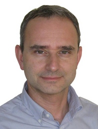
 Alberto Guarnieri received the degree in Electrical Engineering at the University of Padova (Italy) in 1998, then in 2004 he got the PhD in Geodetic and Topographic Sciences at the University of Bologna (Italy).In 2003-2004 he was visiting researcher at the Department of Geomatics Engineering of the Schulich School of Engineering, University of Calgary, Canada. From November 2008 to November 2015 he was assistant professor, and since 2015 he is associate professor at the Department of Land, Environment, Agriculture and Forestry (TESAF) of the University of Padova. His research activity is mainly focused on 3D modeling supported by terrestrial laser scanning and digital photogrammetry for cultural heritage and hydrogeological risk mapping. He is also involved in the development of land-based and UAV-based low-cost mobile mapping systems. He currently teaches higher education courses on Global Navigation Systems (GNSS) and Geographic Information Systems (GIS) at the School of Agricultural Sciences and Veterinry Medicine of the University of Padova.
He has (co)authored more than 130 papers, published on international scientific journals, books and national or international conference proceedings.
He is active in the International Society of Photogrammetry and Remote Sensing (ISPRS), serving from 2012 to 2016 as secretary of Inter-Commission Working Group ICWG I/Va - Mobile Scanning and Imaging Systems for 3D Surveying and Mapping.
|
 Alberto Guarnieri received the degree in Electrical Engineering at the University of Padova (Italy) in 1998, then in 2004 he got the PhD in Geodetic and Topographic Sciences at the University of Bologna (Italy).In 2003-2004 he was visiting researcher at the Department of Geomatics Engineering of the Schulich School of Engineering, University of Calgary, Canada. From November 2008 to November 2015 he was assistant professor, and since 2015 he is associate professor at the Department of Land, Environment, Agriculture and Forestry (TESAF) of the University of Padova. His research activity is mainly focused on 3D modeling supported by terrestrial laser scanning and digital photogrammetry for cultural heritage and hydrogeological risk mapping. He is also involved in the development of land-based and UAV-based low-cost mobile mapping systems. He currently teaches higher education courses on Global Navigation Systems (GNSS) and Geographic Information Systems (GIS) at the School of Agricultural Sciences and Veterinry Medicine of the University of Padova.
He has (co)authored more than 130 papers, published on international scientific journals, books and national or international conference proceedings.
He is active in the International Society of Photogrammetry and Remote Sensing (ISPRS), serving from 2012 to 2016 as secretary of Inter-Commission Working Group ICWG I/Va - Mobile Scanning and Imaging Systems for 3D Surveying and Mapping.
 www: Homepage
Publications
 Email: alberto.guarnieri(at)unipd.it
 Phone: +39 049 827 2713


